synoptic charts: learn - test - check
Synoptic = summary of current situation.

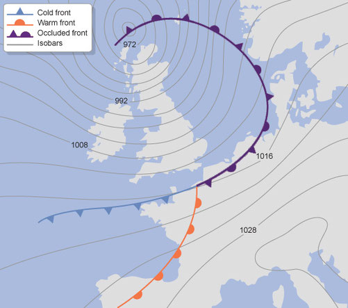
Synoptic Chart Key:
A = Isobar
B = Warm Front
C = Cold Front
D = Pressure in Millibars
E = Occluded Front
F = Trough
G = Low Pressure System
H = High Pressure System
Isobars:

What do isobars tell us?
Wind Speed:
- Closely spaced Isobars indicate large pressure changes causing wind speeds to increase.
Wind Direction:
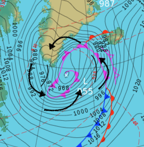
In the Northern Hemisphere Winds will:
- Winds will blow anti-clockwise around an area of Low Pressure (Cyclone)
- Winds will blow clockwise around an area of High Pressure (Anti-Cyclone)
Pressure:
- Lines of equal atmospheric pressure
Wind Direction (Northern Hemisphere):
Winds will blow anti-clockwise around an area of Low Pressure (Cyclone)

Winds will blow clockwise around an area of High Pressure (Anti-Cyclone)

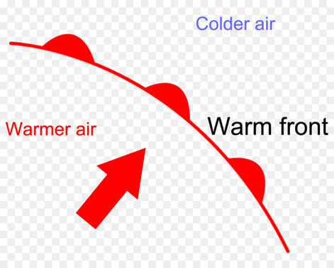
Warm Front:
A warm front occurs when a warm air mass slides over a cold air mass.
These are formed when warm air rises over a mass of cold air. As the air lifts it cools, expands and condenses the water vapour as wide flat clouds. Warm fronts usually bring low and thick cloud & drizzle.


Cold Front:
Usually associated with Depressions. A cold front is a transition zone where a cold air mass is replacing a warmer air mass. The cold air is following the warm air and gradually moves underneath the warmer air.
Commonly, when the cold front is passing, winds become gusty; there is a sudden drop in temperature, and heavy rain, sometimes with hail, thunder, and lightning. Lifted warm air ahead of the front produces cumulusor cumulonimbus clouds and thunderstorms.


Occluded Front:
This occurs where two different air masses meet. A band of thick cloud is created when the cold air catches up with the warm front.
Occluded fronts usually bring sudden downpours of heavy rain.


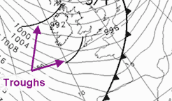
Trough:
A trough is an elongated (extended) region of relatively low atmospheric pressure, often associated with fronts. Most troughs bring clouds, showers, and a wind shift, particularly following the passage of the trough. This results from convergence or "squeezing" which forces lifting of moist air behind the trough line.

